THE PRODUCT
Fly the county from your desk. Open any parcel's file.
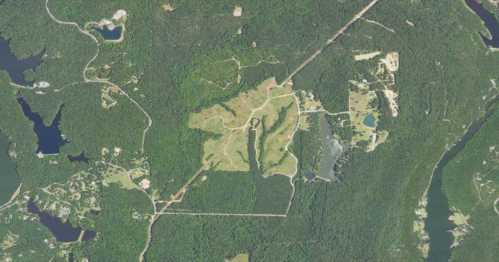
Satellite view with real parcel boundaries drawn on top — click one and every field we hold appears beside it.
18 4 11 0 000 007.000PRIME
399 acres — private owner
Shelby County, Alabama
$1,276,800
assessed · $3,200/ac
SLOPE
10.3%
20% over 15%
FLOOD ZONE
X
Minimal risk
DRAINAGE
Well drained
Septic suitable
ROAD FRONTAGE
4,570 ft
Four Wing Lake Rd
Wetlands presentYes — mapped
Hunting habitatStrong — 9.5 / 10
CreekRuns through it
Wooded42%
Nearest school6.9 mi
Improvement value$0 — raw land
Wetlands mapped on part of the tract — check the overlay before siting a build.
Ask Scout
Which prime parcels over 20 acres have an absentee owner and no flood risk?
412 parcels match. The largest is this 399-acre tract — 4,570 ft of road frontage, Zone X, a creek through it. Worth knowing: a fifth of it is steeper than 15%, and wetlands are mapped on part of it. Want them sorted by price per acre?
Yes — and only the ones with paved road frontage.
Ask about any parcel…
Illustrative parcel — owner, parcel number and price are examples. The aerial imagery (USDA NAIP via USGS The National Map, public domain), the boundary and the terrain figures are real. Nothing here is an appraisal.
Or narrow the whole county to your buy box
Stack filters until the list is short enough to drive.
Undeveloped only10–50 acresSlope under 8%Outside flood zoneSeptic suitableFronts a public roadOut-of-state ownerHunting habitatSewer main nearby
Know the ground before you stand on it.
Free accounts read five full parcel files a month. New counties come online one at a time.
© 2026 MEC Media Co. · meclandscout.com · Map data © OpenStreetMap contributorsCountiesField NotesPricingAboutTermsPrivacyBuilt in Alabama.